Thursday, July 31, 2025

The delightful surprise of Bardon Mill.


Bardon Mill was not part of my plans for walking the Hadrian’s Wall path. The town is too far off the trail and the AD122 bus doesn’t pass through it. Circumstances, however, forced me to book rooms there, and I am glad I did.

Bardon Mill is a little over a mile south of Vindolanda, which itself is two miles south of Hadrian’s Wall. While the museum and excavations at Vindolanda definitely make it worth the detour, I could find no good reason why I should deviate an additional distance to see Bardon Mill. When  you’re walking 10-12 miles a day, addingt hree extra miles is pretty daunting. Most hikers, and that 


includes me, want to find lodgings as close to the trail as possible.

For this section of the trail, that would have meant finding rooms in Once Brewed. However, we were a group of six, and Once Brewed is a very popular place. There were no rooms to be had, and once I began searching, it became apparent that there were no rooms to be had for miles around. I cast my net wider and wider, and finally found lodging for six in Bardon Mill. Some of the people in my group were skeptical about my choice, and I couldn’t blame them.

The trail south from Vindolanda made it clear that Bardon Mill is not overly popular with hikers. It was

not well marked, and we got lost a couple of times, but basically, the trail runs down a little valley through a lush forest. We saw no one else as we walked. At the bottom of the valley, we had to cross a very busy freeway, the A69, but once we had, we were enchanted by what we saw.


Errington Reay & Co is the only commercial pottery in the United Kingdom that is currently licensed to produce salt glaze pottery.  It was established in the village in 1878 and appears to still be going strong.It was right next door to our lodgings, so that when I looked out my window, I saw pottery. They made a large variety of wares, including these delightful chickens.


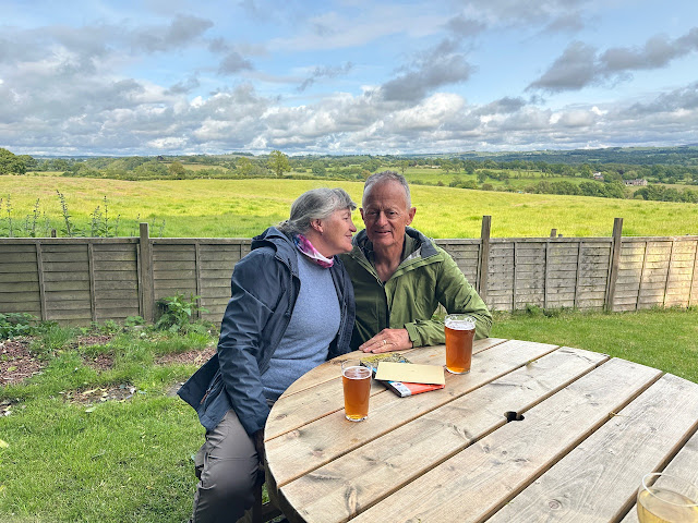
We stayed in the Bowes Inn, the pub that also seemed to be the center of social life in this village of 450 people. The staff was welcoming from the moment we walked in the door. We ate breakfast (included with the room) and dinner with them, and they packed lunches for us to eat on the trail.


While we were there, there was a pool tournament going on in the pub. Apparently, the Leek club has a show here every year, at which the produce from which is auctioned off to raise funds for local charities. Bardon Millers are evidently very proud of their leeks. There were numerous pictures of them on the walls of the pub. 

But their hospitality didn’t end there. Knowing that there was no bus to accommodate us, we were offered rides up to the wall. Because they are not a taxi service, our drivers could not charge us a fee, but hoped that we would provide them gas money, which we willingly did. We stayed two nights. The first morning we got rides back to Steel Rig, so that we could walk from there to Housesteads. This allowed us to walk some of the trail we missed by taking the bus from Walltown Quarry to Vindolanda, and we were glad we did because that section of the trail was spectacular. The second day we got rides to Housesteads so we could continue on our way east along the wall.

This was a bit of an inconvenience for the staff. Because they have no bus and there are no schools in the village itself, their own children need rides to schools in the neighbouring villages of Henshaw, Haltwhistle, and Haydon Bridge.  Offering rides to hikers is a second priority. I got the feeling that this town would love having the AD122 pass through, both so that their children could use it and to attract more tourists.

The staff at the Bowes Inn treated us like family, the food was good, and the rooms were cozy and quiet. By the time we left, we were all in agreement that staying in Bardon Mill was not the bad idea we had all feared.


Wednesday, July 23, 2025

The History of Isle Royale


Isle Royale is an island in Lake Superior. If you look at a map of the lake and think it looks like a wolf looking left, Isle Royale would be the eye of the wolf.

The island's history spans thousands of years. During the last Ice Age,15,000 to 20,000 years ago, Isle Royale was covered with thick glacial ice. About 10,000 years ago, the ice receded from the Lake Superior basin and Isle Royale rose above the waters of the lake. Its rocks, which are layers of lava flows and conglomerates formed during the Mesoproterozoic era, were tilted up by the weight of the glaciers, then eroded into long fingers that were then surrounded by water. This gives the eastern side of the island the look of fiords.  


We may never know when the first human ventured across the waters to land on the shore of Isle

Royale, but it is certain that people had arrived by 2,5000 BCE or soon thereafter. Early visitors mined raw copper, searching for nuggets and veins of the bright metal, then beating it out of the bedrock with rounded, hand-held beach cobbles. Archaeologists have found large numbers of these hammerstones along Minong Ridge, which has many of these ancient mines. More than 1,000 pits attributed to the Indians have been located on the island, but none include habitation sites. 

The Ojibwa call Isle Royale as "Minong," meaning "the good place." This may be because of the abundance of berries, including thimbleberries and blueberries.They mined copper and fished in the surrounding waters.Isle Royale remains within the traditional homelands of the Grand Portage Band of Lake Superior Chippewa.

European contact began with the French during the Seventeenth Century. Fur traders, including Brule in 1622, Nicolet in 1634, and the Jesuits Raymbault and Jogues in 1641 lead to increased interest in the island's resources, including copper and timber. However, the remoteness of the island and the challenging weather and sailing conditions limited the area's use.


In the 1840s, Michigan's first state geologist, Douglass Houghton, reported on the wealth of copper on the island. That began a copper boom that lasted into the late 1890s. Unfortunately for the island, a common way to locate copper deposits was to burn forests, exposing surface rock. After the mining boom ended in the late 1890s, incidence of fire decreased and Isle Royale was not devastated by fire again until the 1930s, when it suffered its most devastating fire.

Fires, along with strikes and storms, also drove out the lumber industry, which tried to make a go of it on the island between 1892 and 1935. 

The longest-lasting industry on Isle Royal was commercial fishing. While historical records are scanty,

it's likely that The Northwest Fur Company got fish for its stations at the head of the lake in Western Lake Superior from the north side of the island sometime in the late 1700s. By the 1880's, from twenty to sixty crews came from the mainland to fish every year. They arrived in June and left in November, selling their catches to steamers from Duluth that made regular trips to the island to pick up fish and deliver supplies. During the early period, most fishermen were Cornish, English, or French. By the turn of the century, Norwegians, Swedes began to arrive, attracted by how similar the environment was to their homeland. Few fishermen or their families stayed on the island year-round. The isolation of the island once the lake froze, and the bitter weather permitted on the hardiest to stay.


Along with mining, lumber, and fishing, tourism tried to make a commercial success of itself on Isle Royale. Beginning in 1855, it established itself as a health destination, where cool weather and clean air could cure the sick. In the 1860's and 1870's, excursion boats carried travelers to the island, to picnic at the site of the Siskowit Mine or near the Rock Harbor lighthouse. Resorts were established on both sides of the island, and people from Minnesota, Michigan and Illinois began buying property for summer homes.


Private ownership of the island was not to last, however. In the 1920s, conservation efforts gained momentum, with advocates pushing for the island's preservation as a wilderness area. While some of the landowners were strong in support of the movement to create a park, others were not. In 1931, Congress authorized the establishment of Isle Royale National Park and the National Park Service began

acquiring all the lands and buildings belonging to the fishermen and summer residents. Some of those owners were given life leases.


The park was officially established on April 3, 1940, by President Franklin D. Roosevelt.

_____________________________________________________

Jennifer Bohnhoff is a former English and History teacher who now writes contemporary and historical fiction for middle grade through adult readers. Perspective, her novel set on Isle Royal in the 1930s, will be published in October, 2025. You can preorder the ebook or paperback now. 


Saturday, July 19, 2025

Walking the Wall: Day Four, Gilsland to Bardon Mill


If anyone were to ask me where to start an abbreviated hike of Hadrian's Wall, I would recommend Gilsland. The little village of Gilsland is small enough to be quaint, yet large enough to have some very nice features for hikers, the most important of these being the Samson Inn. Founded in 1601, this inn is the heart of the village in more ways that one. Back in 2022, the former owners decided to put it on the market. When no one stepped forward to keep the inn running, the village, realizing how important the Samson is not only to hikers, but to the community, decided to buy it itself. They formed the Gilsland Community Benefit Society Ltd (GCBSL), and after much grant writing and fundraising, which included pie sales and raffles, they were able to purchase the establishment. In October of 2024, after a renovation and thorough cleaning, the first pint was poured in the reborn pub. We weren't able to stay there, because the Inn was not yet taking reservations when I was scheduling this walk, but we did eat all our meals here and I can say they are friendly and helpful and we thoroughly enjoyed meeting the locals and sensing their pride in having kept this inn going.

Another place in town that I had intended to patronize was House of Meg, a tea room that comes highly recommended. Unfortunately, they were already closed when we made it into Gilsland, and it was still closed the next morning when we left. 

Today was supposed to be an 11.5 mile day, but we decided to use the AD122 bus, which shortened things up considerably. I'll explain why as I tell you about the day. 


We left Gilsland on a cool and misty morning. Almost immediately, we were following the vallum, the huge ditch that runs along the southern side of Hadrian's Wall. The vallum is a unique feature, the only such ditch to run along any frontier in the Roman Empire. It was built a few years after the wall and is believed to mark the southern boundary of a military zone which is bounded on the north by the wall.

The word vallum actually means wall, and Hadrian's Wall itself is called Vallum Adriano in Latin. The Venerable Bede, an historian who lived in the eighth century provides the earliest surviving mention of the ditch. He refers to it as a vallum, or earthen rampart instead of as a fossa, and the term has set.


We soon came to Thirlwall Castle, a twelfth century home that was fortified in about 1330 by John Thirlwall. It stayed in the family despite the fact that Sir Percival Thirlwall was killed while acting as Richard III's standard-bearer at the Battle of Bosworth in 1485. A survey in 1542 stated that Robert Thirlwall owned the castle and it was in good repair, but in 1748 it was sold to the Earl of Carlisle, who had no use for yet another castle and allowed the structure to fall into decay. It is now an English Heritage Site, and they are working to protect it from further dereliction.                                                                                                 

We found ourselves walking along the wall quite often. Sometimes we were in the vallum, and sometimes we walked beside it. We also found ourselves crossing over walls that divided one pasturage or field from another. There were ladder gates and "kissing" gates, and others whose names I do not know. 


When we could see Walltown Crags looming through the mist, we knew it was time to stop at the Roman Army Museum. This museum is tied with a Roman fort known as either Carvoran  or Magna and is run by the same people who administer Vindolanda. It is not an English Heritage site, but we found it was well worth the price of admission. I especially enjoyed their film, Edge of Empire, which showed computer-animations that began with an archaeological site, then built up the building that had once stood there. 


In fact, the museum was so great and the weather had disintegrated so badly that we decided to pick up the AD 122 and take it all the way to Vindolanda, despite the fact that in doing so we would miss a good section of wall here, including Turrets 44B and 45A and Walltown Quarry. We'd also miss another English Heritage site,  Great Chesters Fort (Aesica) , which has the most complete Roman cavalry fort in Britain and a tearoom that came highly recommended.


We ate our sack lunches on the AD122 bus https://www.gonortheast.co.uk/services/GNE/AD12 while rain spattered on the windshield. Although we felt a little disappointed in missing part of the wall hike, another walker who stayed in the same inn as us told us that he slipped and fell on the wet stones, and that the rain was vicious on the top of the crags. that made us feel a little better about our choice. 

The bus dropped us off at Vindolanda, a fort that was built along the Roman road several decades before Hadrian began his wall. It is an excellent museum and archeological site, and we were glad that we'd created extra time to visit it. Vindolanda deserves at least three hours, and even then it has so much information and things to see that it is worth a blog all by itself.  

When we were done with the museum, we hiked a little less than two miles to Bardon Mill, where we stayed at the Bowes Hotel, a lovely quaint Inn that treated us like family. 

So why would I recommend Gilsland as the start of a shortened Hadrian's Wall hike? It was there that we truly began seeing the wall and vallum regularly, and that the scenery became spectacular, but it is also the first place where the AD122 can be accessed. Because of that, it would be possible to use Gilsland as a base to hike all the best miles and see all the best museums along the wall. We could have stayed here for days, yet we continued on, and the walking became more and more beautiful and challenging.

My visit to Isle Royale


During the summer of 2000, my husband, three sons, and I went to Isle Royale National Park. If you have never been to Isle Royale, you're not alone. One of the least visited national parks in the United States, it attracts only around 25,000 visitors per year. In comparison, Yellowstone National park had 4.74 million visitors in 2024, and Great Smoky Mountains, the most popular national park in the United States, attracted over 12.1 million visitors.

One reason this park is so undervisited is because it's a challenge to reach. An island in Lake Superior, it can only be visited by boat or seaplane. Private boats can come to the Isle, but we, like most visitors, took a ferry. The Voyageur II runs from Grand Portage, MN.  It and its sister ship, the Sea Hunter III, reach Windigo in about 2 hours, but the Voyager continues on, traveling to Rock Harbor in about 8 hours. All along the way, it picks up and drops off passengers and, back when we traveled, mail and supplies for Islanders. Another company, The Royale Line, runs from Copper Harbor, MI, to Rock Harbor in 3.5 hours, and the Park Service (nps.gov/isro) runs the Ranger III from Houghton, MI, to Rock Harbor in about 6-hours.Isle Royale Seaplanes flies from Hancock, MI, and Grand Marais, MN, to Windigo or Rock Harbor.

Because of the severity of conditions on Lake Superior, the park is only open from mid-April through October. Weather can be unsettled in spring and fall; stormy conditions on Lake Superior affecting transport. Both Rock Harbor and Windigo have visitor centers that can help you orient and educate yourself, and can rent canoes and other supplies. They are open daily in season, with reduced hours outside of July and August. A visitor center at park headquarters in Houghton, Michigan is open year-round.

Once you've arrived, you'll find that Isle Royal is very rustic. 45 miles long and 9 miles wide, it has just one hotel, the Rock Harbor Lodge. The lodge's room have private baths, plus there is a dining room and a dockside store. Windigo has rustic one-room cabins, and there are 36 campgrounds scattered throughout the shores, and lakes, and promontories of the island. 17 of these campsites can accommodate larger groups.Some are nothing more than a flat spot and a fire ring, while others have three sided cabins, the fourth side covered in screen to keep out the mosquitos. We carried tents, sleeping bags and a backpacking stove, but welcomed the one cabin we came to during our five day trek. Non-fee permits are required for all camping and overnight boat docking or anchoring. Parties of 1 to 6 get permits on arrival but cannot reserve any specific sites. Groups of 7 to a maximum of 10 must reserve sites and obtain permits in advance through park headquarters.


Isle Royale National Park was designed to be a wilderness. It has no roads. If you want to travel the
island, you use one of the many foot trails, or a network of water routes for canoes and sea kayaks.The Greenstone Ridge Trail begins at Rock Harbor and follows the island's rocky spine, connecting numerous trails that drop off towards both the southern and northern shores in a web of hiking possibilities. This picture if of my three boys sitting on the granite rock at the island's highest point. 

We landed at Rock Harbor, where we rented three canoes for the five of us. Our youngest was just six, and we would have liked to have only rented two canoes, but regulations forbid three people in any boat. Because of the nature of the landscape, we found ourselves hiking the fingers of land on the east side of the island, while portaging our canoes, then paddling across the inlets. This proved to be tricky, since only my husband and my oldest son were strong enough to portage a canoe. While the two of them hefted the canoes, my middle son and I carried all of our gear, which was stored in five backpacks, while the youngest loaded himself up with all our life vests and waddled his way to the next shore. Some of the portages were over a mile, and we had to cross back and forth several times to transfer all the equipment. 

We never got out into Lake Superior itself, which can be too rough for canoes. If we had, we might have been able to look down at some of the shipwrecks that ring the island, grim monuments to rocky reefs and shifting fog. Some people scuba dive down to these wrecks.

We had a wonderful time on Isle Royale, but it was something that happened as we were leaving that
inspired me to write Perspective. The ferry had stopped near a rustic cabin that sat on the waterfront, and one of the sailors was handing mail and a box of groceries to a woman onshore. When I said that I'd like to own a cabin on the island, someone explained to me that it was impossible. When the island became a national park in 1940, some (but not all) of the people who owned land on the island were granted life leases. That allowed them to continue using their cabins until the grantee died. In 2000, it had been 60 years since those leases were granted, and most of the grantees were growing old. In the years since, they've died off, and the park service has taken control of the land. It made me wonder what it would have been like to be one of the families that lived on the island, and that wonder became the seed for a whole novel. 

Monday, July 14, 2025

Peaches and Cream Baked Oatmeal


 I've been busy editing my cowboy romance and prepping my middle grade historical novel for a fall publication, but then my sister arrived with two flats of peaches! Heather lives in Alamogordo, some 200 miles south of me, and her spring starts nearly a month before mine does. Her summer lingers well after I've gotten my first frost, too. It's paradise for sunbirds and for gardeners, as long as they don't mind the heat!

Two flats of peaches aren't going to just sit around on my counter as I write, so I took a break before the fruit flies invaded. I've now got five bags of peaches in the freezer, we've had fresh peaches for breakfast, lunch and dinner the last couple of days, and I've made a peach cobbler, a peach upside down cake, two peach pies, seven jars of jam, and I've tried one new recipe: a breakfast dish that can be served room temperature or warm from the oven. It was so good that I decided to share it with you. 

Peaches and Cream Baked Oatmeal tastes like it should be dessert, and I guess it could be if served with a dollop of ice cream or whipped cream. But it's pretty healthy, fairly low in sugar and fat, so why not enjoy it at breakfast time? I made it in advance, so that I could eat it right after coming home from the pool, where I swim a mile during the 6 am session. 

Peaches and Cream Baked Oatmeal

  • 1 1/4 cup nonfat milk, plus 1 TBS, divided
  • 1/4 cup sugar, plus 1 TBS, divided
  • 1 egg
  • 2 TBS butter, melted
  • 2 tsp vanilla extract, divided
  • 2 cups old fashioned rolled oats
  • 1 tsp baking powder
  • 1/4 tsp. salt
  • 1 cup peeled and diced fresh peaches
  • 4 oz. nonfat cream cheese, softened
  • 3 TBS peach jam

Preheat oven to 350°. Coat an 8" baking dish with cooking spray.

Whisk 1 1/4 cups milk, 1/4 cup sugar, 1 egg, melted butter and 1 tsp vanilla together in a large bowl until smooth and the sugar is dissolved. Add the peaches, baking powder, salt and stir well. Pour mixture into the prepared baking dish and let stand for 15 minutes to let the oatmeal soak in the milk a bit. 

Combine cream cheese, 1 TBS milk, 1 TBS sugar and 1 tsp vanilla and beat together until smooth and creamy. Spoon the cream cheese mixture over the oat mixture using a tablespoon. Place a spoonful of peach jam into the places that are not covered with cream cheese. Cut through the mixture several times to mix slightly, creating a marbled effect.

Bake until very lightly browned and set, 30-35 minutes. Let cool for at least 10 minutes.

Can be refrigerated in an airtight container for up to 1 week.  

Wednesday, July 9, 2025

Walking the Wall: Day Three, Walton to Gilsland


Sunday, June 8 was the day that our hike along Hadrian's Wall got really interesting. We had embarked on this walk from Bowness-on-Solway, the western-most edge of the wall, and we had walked from there to Carlisle, the biggest town on the western section, and then on to the charming village of Walton, but it wasn't until the third day of our walk that we actually began seeing the wall. This little section, at a place called Hare Hill, might be the tallest remaining piece of the wall. Or it might be a 19th century reconstruction. Or it might be what is left of a barn that way made out of wall stones. Whatever it is, it thrilled us. After walking along the path that once held a wall, we were actually seeing wall! Then, almost immediately after seeing the wall, we deviated away from it.

On our third day, we walked what looked like 9.18 miles on the map, but actually ended up being a lot

longer because there were so many interesting things to walk through and around. The first of those things was Lanercost Priory. Founded in 1166 and built of stones taken from the wall, Lancercost was very important during the middle ages. Edward I rested here for five months as he tried to regain his health so that he could battle the Scots. He never made it, dying in Burgh-by-Sands, where his body laid in St. Michael’s church until being transported back to London. 

Lanercost still serves as the parish church. There is a completely intact chapel that seats several hundred, and behind it lies the ruins of the older priory. As we walked through the ruins, the organist was warming up, giving us a background of beautiful music. The ruins are beautiful and haunting, and there are medieval memorials, Victorian gravestones, and Roman altars, giving a sense of the time that has passed and the lives affected by this church. 

Lanercost is an English Heritage site, so if you've bought a pass, it's free to enter. It had a lovely tea room, where we had an early lunch.


Ano
ther hour and a half on the trail and we got to Birdowald, which is also an English Heritage Site, and place to stamp our passports. It is one of the best preserved of the 16 forts along Hadrian’s Wall and is situated in a commanding position on a triangular spur of land bounded by cliffs to the south and east overlooking a broad meander of the River Irthing. In Roman times, the fort was known as Banna (Latin for “spur” or “tongue”), reflecting the geography of the site. Birdowald had a lovely little museum that was geared to kids. 

Close to Birdowald we crossed the border from Cumbria into Northumberland. We also crossed a geological border that day, the place where sandstone was replaced by the longer lasting limestone, which explains why we were seeing more and more of the wall. 

That night we stayed in a house in the village of Gilsland. We had two bathrooms for the six of us -- a luxury after sharing one bath at the bunkhouse -- and we had a washer/dryer that worked quite well once we figured out how to use it. 


But the real "find" in Gilsland was the Samson Inn.  This lovely old inn had closed last year. The village, realizing how vital it was to the economy and life of the place, ended up buying it when no one stepped forward. They''ve hired a manager and workers, and the inn now serves meals and has rooms to let. We ate dinner and breakfast there, and they packed us lunches. We were delighted with the place and wish it well in the future. 

The next morning we headed out, knowing that some of the most beautiful and educational days lay ahead of us. 


Friday, July 4, 2025

Walking the Wall: Day Two, Carlisle to Walton

 This summer, my husband, four friends and I walked the English Heritage Trail that follows Hadrian's Wall. We began in the far west, at Bowness-on-Sol and walked east with the prevailing winds at our back. Our first day took us 15 miles, to the town of Carlisle

Day 2 was going to be a shorter hike: just 12 1/2 miles. This section the path went through farmland, and there was very little stone evidence of the Wall. This part of England has more sandstone than limestone, and it is softer and disintegrates more readily. Like in both the far west and the far east, much of the wall was pulled down by later generations, who used the stone in their own building projects. However, we did get to see some raised foundations on occasion, and often saw evidence of the vallum, the huge earthwork that ran along the south side of the Wall.


Because this section of the trail is very rural, we picked up lunch supplies at a grocery store in Carlisle before we set out. It was raining fairly hard as we were leaving Carlisle, and this caused a bit of difficulty. We needed to cross town to join the trail, and google maps was not very helpful in showing me which routes were just for cars and which routes were pedestrian friendly, nor did it show where fences barred the way. The rain didn't help, either. Every time a raindrop hit my phone's screen, the arrow jumped to it and I lost track off where I was! We added a little bit to what was supposed to be a short day by backtracking several times before we managed to get to the trail. 


A riverside path took us along the banks of the River Eden until we reached Memorial Bridge, where we crossed and entered Rickerby Park. We passed a War Memorial before we left the park and entered the countryside. Like many of the monuments in Britain, both the bridge and the memorial are dedicated to the fallen of the First World War. This is a testament to how devastating that war was to the country, where approximately 880,000 men died. That amounts to  6% of the adult male population and 12.5% of those who were serving. In comparison, Britain lost only . 384,000 soldiers in World War Two. 

We followed the path past Carlisle Airport and many farms. The guidebook noted that one stretch, named Sandy Lane should have been named Clarty Lane, the word clarty being a local term for muddy. In one field there was the remains of an old tower, but the guidebook didn't provide any more information that the words "tower in field" to explain what it was. I fancied it an old outpost from the Norman era, looking for marauders coming down from Scotland. 

As we neared Bleatarn Farm, the trail was slightly raised and arrow-straight. We were walking on the old Roman road! Bleatarn Farm is the site of an old Roman quarry. Its name mean Blue (blea) pond (tarn), and the pond that's mostly silted up is believed to once hold the fish used to feed the soldiers working in the quarry. Walking over history like this is eerie. I'm glad I had a guidebook that pointed out the shape of the landscape or I might never have noticed what I was walking through. 


The little town of Newton had an honesty-box snack shed that carried sandwiches and soups in addition to the usual cookies, chocolate bars, and drinks. We didn't eat there, but we did shelter from a squall that passed through, and we were grateful for the hospitality. 

Walton was only was only a little ways beyond Newton. It is a small town, and it was difficult to find room for six hikers there. We stayed in the Sandysike Bunkhouse, a converted stable that had four bunk beds in a single room. It also had a little room with a fireplace, a kitchen, and a bathroom with a shower, toilet, and sink. The farm had a little more upscale accomodations, but they didn't sleep 6. 

Our accommodations weren't plush by any means, but they were cozy, and it was fun to meet the family who lived in the farmhouse. Diccon, the farmer, drove us into Walton and proudly pointed out that the gate in front of the village church was paid for by his grandfather. His twin toddlers were a delight to see mucking about the farmyard in their tiny wellies, and their dogs came and visited us in the bunkhouse. Dicon's father, Richard, enjoyed telling us stories about the old days.


And because it was my husband and my anniversary (45 years!) we stopped at The Old Vicarage Brewery for a celebration pint. They have a bed and breakfast, and offer dinners and packed lunches to people who stay with them.


That night we all slept soundly, excited that we'd finally see some above-ground traces of the wall on Day 3


Wednesday, July 2, 2025

Walking the Wall: Things to See in Carlisle


Carlisle is the biggest town along the western side of Hadrian's Wall, and is filled with great things to see. Its occupation goes way back to before the Roman invasion, when, according to a 6th century writer named Boethius, the area was a stronghold of the Carvetii tribe.

When the Romans came, they established a settlement called Luguvalium where Carlisle is today. The settlement is named after Lugus, a British/Celtic god whom Julius Caesar thought was synonymous with the Roman God Mercury. Most of what we know about Carlisle in Roman times comes from the writing of Tacitus. The ruins of a Roman fort, constructed in AD 73 out of timber, lies beneath Carlisle Castle. The fort protected a strategic location on the Roman road to the north and overlooked the confluence of the Caldew and Eden rivers.

By the early 2nd century, Luguvalium was one of several forts strung along the Stanegate, a road that

stretched from Carlisle to Corbridge. In AD 122, Hadrian visited the province and began the building of his wall. A new fort was built in the northern part of the Carlisle. Named Petriana after a 1,000-strong cavalry regiment that was housed there (the Ala Gallorum Petriana Petriana), it was the largest fort along the wall. There is an ongoing archaeological dig at the Carlisle Cricket Club that regularly unearths artifacts from the Roman period. 


Because it is only eight miles from Scotland, Carlisle was an important military stronghold throughout the Middle Ages. Mary, Queen of Scots was imprisoned in its castle in 1568. When the Industrial Revolution began in the 19th century, it became a mill town boasting seven railway companies.

When we arrived in Carlisle at the end of our first day of hiking the wall, our first stop was at the Sands Center by Eden Bridge. That is where we got our second stamp on our passport. The Hadrian's Wall Passport is a fun souvenir, whose purchase supports the National Trail System, particularly the maintenance of the wall, its trails, and archaeological digs along the wall. Collecting the seven stamps available along the 84 mile journey can be a challenge!


We stayed the night in the County Hotel, which was conveniently located next to the train station and close to the bus station. While inexpensive, the hotel was old and a little shabby, but the real sticking point was thin, single pane windows that let in all the street sounds. There was a restaurant right under our room, and the voices and music continued until sometime after 2 in the morning. 

Because we were afraid that tacking on sight-seeing after walking fifteen miles would be just too hard, we'd  toured many of the sites in Carlisle the day before, when we were passing through on our way between Edinburgh and Bowness-on-Solway.  Here are things I recommend:

If you are not staying in Carlisle, I recommend storing your luggage for the day to make sightseeing easier.  We found a place just feet from the train station, so we didn't have to lug our things around.


We picked up our English Heritage Passes at Carlisle Castle. The pass for overseas visitors is available for 9 or 16 consecutive days, and saved us a lot of entrance fees. You can buy it online and collect it at any of its sites, including the CastleCarlisle Castle, built in 1092 by William Rufus, using stones from Hadrian's Wall, is still relatively intact. It now houses the Duke of Lancaster’s Regiment and the Border Regiment Museum.

We also visited the Carlisle Cathedral, which was free and had an interesting little museum down in its basement. One person we met along the way told me that Oliver Cromwell tore down some of the cathedral, and it was rebuilt later. If you walk around it, you will see that it definitely was built at different times. Some of the windows have round casements and some have pointed ones. 

I especially liked the choir area, which had richly carved seats. 

Our time in Carlisle was limited, and there were some places we missed, much to my regret. 

The Tullie House Museumwhich is named after the Jacobean mansion in which it is located, features exhibits on the Roman occupation of the region, Hadrian’s Wall, and the Border Reivers.

St. Cuthbert’s Church might have its origins before St Cuthbert's visit to Carlisle in 685. The Church stands square to the Roman Road and has a unique moving pulpit, a fourteenth century window, a window commemorating our hospitality to a Latvian Lutheran congregation, and a very attractive series of windows depicting the life of St Cuthbert.

The Guildhall Museum is which is based in a 14th-century house and hosts exhibits related to the city’s 8 medieval trade guilds, is closed until further notice.

Carlisle is one of the biggest towns along the Wall Trail, so it's a good place to do some shopping. One of our party needed new hiking poles, and there was an outdoor equipment store that had them. We also bought supplies for a picnic lunch at one of the grocery stores before we headed out to begin our second day along the trail. 

 As we left Carlisle, we passed two more sites that are worth a look. We took a riverside path along the


banks of the River Eden until we crossed at the Memorial Bridge, a lovely old suspension bridge. We then entered Rickerby Park, where a War Memorial dedicated to the fallen of the First World War sits close by the trail. 


We continued walking. On this, our second day on the Hadrian's Wall Trail, we encountered some rain, but we were determined to make it to Walton by nightfall. 


Walking the Wall: Day 8, Corbridge to Robin Hood Inn

I walked Hadrian's Wall with my husband and four friends during June 2025. This is an account of our eighth day on the trail.  When we ...